Contact Details

Share:

The Cleveland Way Walking Route Kildale to Saltburn

Distance: 14.75 miles (24 Km) 

Start Kildale YO21 2RG 

Finish Saltburn TS12 1EH 

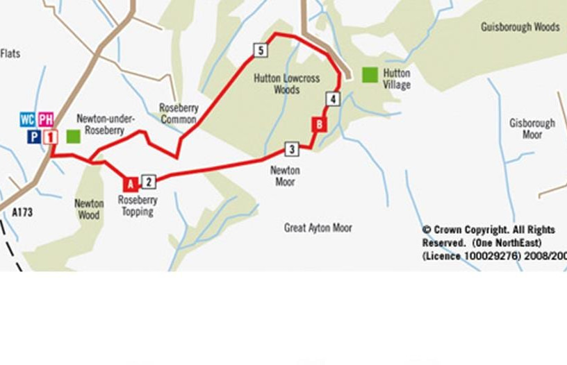
Heading north from Kildale, you will cross the Esk Valley railway line, one of the few surviving “country” lines. You will soon come upon Easby Moor, where the unmistakable Captain Cook’s Monument stands tall, erected in 1827 to commemorate the explorer. Not far from the monument is Roseberry Topping, nicknamed “Yorkshire’s Matterhorn” due to its distinct shape, with a summit of 320m (1050 feet). From here, you can enjoy a panoramic view of the North York Moors. If you make a detour to Great Ayton, you can visit the newly revitalised Captain Cook Schoolroom Museum.  

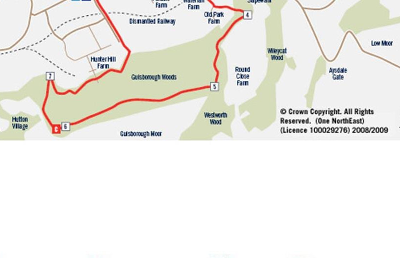
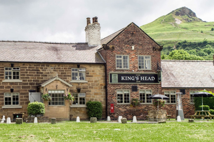
Afterwards, you can continue east to Guisborough Woods, the longest stretch of forestry on the Cleveland Way. Here, you can take in views of the plain below and of Guisborough from Highcliff Nab. At the foot of the Woods, you will find the Guisborough Branch Walkway and Visitor Centre. If you need a refreshment, the Fox and Hounds Pub at Slapewath is close by. Finally, you will come to Skelton, where you will pass through Saltburn Woods to reach the sea at Saltburn. 

For maps and more information see here https://www.nationaltrail.co.uk/en_GB/trails/cleveland-way/route/ 

Banner image courtesy of Colin Carter

Location

Kildale, Whitby, UK

Distance

14.75km

Recommended Start/Finish Points

Kildale YO21 2RG
Saltburn TS12 1EH

Where's Nearby

Things to See & Do

Roseberry Topping

2.77 miles away

Roseberry Topping

At just 1,049 feet (320 m) high, Roseberry Topping may not be the biggest hill you'll ever see, but it will certainly be one of the...

Things to See & Do

Guisborough Woods and Highcliff Nab

2.83 miles away

Guisborough Woods and Highcliff Nab

DISTANCE: 10.5 KM (6.5 MILES) GRADE OF WALK: MODERATE TIME: 2-3 HOURS EXPLORER MAP: OL 26 Get away from it all with a forest ramble...

Things to See & Do

Roseberry Topping – Walking Route

3.25 miles away

Roseberry Topping – Walking Route

Route Details DISTANCE: 6.5 KM (4.0 MILES) GRADE OF WALK:STRENUOUS TIME:2-3 HOURS EXPLORER MAP:Oulioor Leisure 26 Blow the cobwebs away on one of Tees Valley's...

Accommodation

The Kings Head at Newton-under-Roseberry

3.39 miles away

The Kings Head at Newton-under-Roseberry

The King’s Head Inn in the picture-postcard village of Newton under Roseberry is your gateway to the North York Moors National Park and the Cleveland...

Accommodation

Bousdale Old Stables

3.40 miles away

Bousdale Old Stables

Bousdale Old Stables is a self-catering holiday cottage on the edge of the North Yorkshire Moors National Park. The holiday accommodation is particularly spacious and comfortable....

Food & Drink

The Stables at Pinchinthorpe Hall

3.56 miles away

The Stables at Pinchinthorpe Hall

Pinchinthorpe Hall is a country Manor House from the 12th century, based between Guisborough and Newton-Under-Roseberry. They are currently in the process of restoring the...

Food & Drink

Whinstone View Bistro and Lodges

3.77 miles away

Whinstone View Bistro and Lodges

A fine-dining Bistro and leading venue with separate spa and lodges. Whinstone View is the perfect getaway located just on the outskirts of Middlesbrough under Roseberry...

Accommodation

Rose Garden Cottage

3.92 miles away

Rose Garden Cottage

Boasting a modern kitchen, a fantastic wood burner and wood-effect floor in the living room, and a split level bedroom, this property definitely has the...

Stay up to date

Sign up below to enter our mailing list for the Tees Valley Newsletter

Subscribe 
Follow Us

Join us on social media for the latest news