Contact Details

Share:

Clay Bank

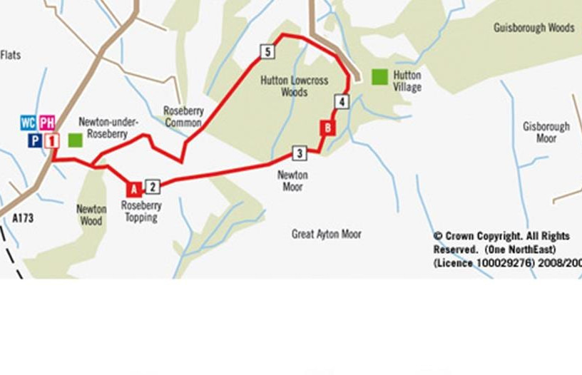
Check out this stunning hiking route in Teesside. The Clay Bank to Carlton Bank trail is about four miles long and offers panoramic views of the region. With landmarks like Roseberry Topping, it’s no wonder it’s been voted one of the UK’s most beautiful hikes.

Location

Clay Bank, Middlesbrough, UK

Distance

6.4km

Where's Nearby

Food & Drink

Market Bar and Grill at Chapters

3.81 miles away

Market Bar and Grill at Chapters

From a delightful new menu serving Monday to Saturday to our always popular Sunday lunches that are sure to make any family get together memorable,...

Food & Drink

The Truffled Hog

3.82 miles away

The Truffled Hog

A contemporary take on the traditional Delicatessen, Wine Bar & Kitchen. British farmhouse fine cheese, charcuterie & small plates.

Things to See & Do

The Cleveland Way Walking Route Kildale to Saltburn

4.01 miles away

The Cleveland Way Walking Route Kildale to Saltburn

Distance: 14.75 miles (24 Km)  Start Kildale YO21 2RG  Finish Saltburn TS12 1EH  Heading north from Kildale, you will cross the Esk Valley railway line, one of...

Things to See & Do

Kildale Falls

4.22 miles away

Kildale Falls

Properly known as 'Old Meggison Falls', surprisingly this delightful beauty spot has only recently made it onto the local radar, so you can still expect...

Food & Drink

Whinstone View Bistro and Lodges

4.93 miles away

Whinstone View Bistro and Lodges

A fine-dining Bistro and leading venue with separate spa and lodges. Whinstone View is the perfect getaway located just on the outskirts of Middlesbrough under Roseberry...

Accommodation

The Treebridge Hotel

5.22 miles away

The Treebridge Hotel

The Treebridge hotel oozes considerable charm & character, with stunning views across open countryside to the nearby Cleveland hills. The hotel also enjoys considerable history...

Things to See & Do

Roseberry Topping

5.22 miles away

Roseberry Topping

At just 1,049 feet (320 m) high, Roseberry Topping may not be the biggest hill you'll ever see, but it will certainly be one of the...

Things to See & Do

Roseberry Topping – Walking Route

5.32 miles away

Roseberry Topping – Walking Route

Route Details DISTANCE: 6.5 KM (4.0 MILES) GRADE OF WALK:STRENUOUS TIME:2-3 HOURS EXPLORER MAP:Oulioor Leisure 26 Blow the cobwebs away on one of Tees Valley's...

Stay up to date

Sign up below to enter our mailing list for the Tees Valley Newsletter

Subscribe 
Follow Us

Join us on social media for the latest news